Expert, precise,
and built to last
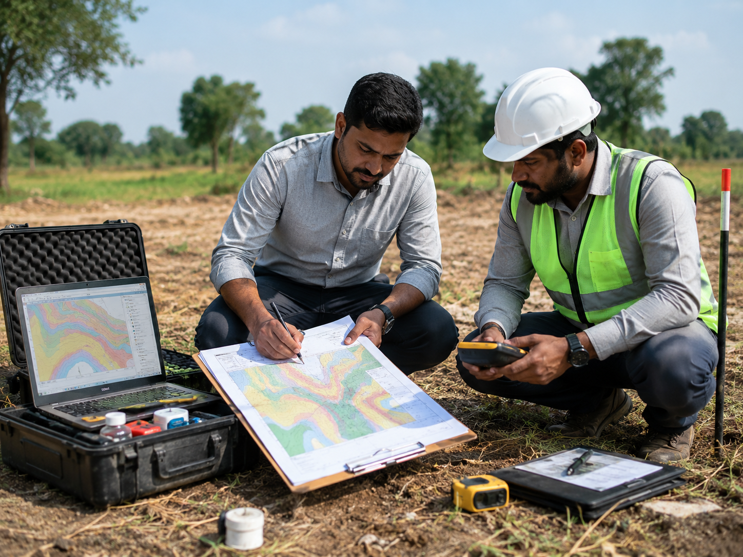
Our groundwater assessment service uses resistivity surveys, geological mapping, and local aquifer data to pinpoint the most productive drilling location on your site. This reduces dry-hole risk significantly and ensures your borewell is placed for maximum yield and long-term reliability.
A solution built for every site
Whether you are a homeowner in Bangalore, a farmer in rural Karnataka, or managing a commercial property — we tailor every groundwater assessment project to your specific land, geology, and water needs. No template approach, no guesswork.
Get a free consultationOur process
Step by step — exactly how we deliver your water solution.
We review existing geological data, satellite imagery, and local borewell records for your area.
Dedicated to precision
Everything we do is focused on delivering the most reliable, long-lasting water solution for your property. With innovation and scientific assessment at the core of our approach, your project will be completed to the highest standard.
Related services
Other services that may complement your project.
Borewell Drilling
Find out more about Borewell DrillingRainwater Harvesting
Find out more about Rainwater Harvesting
Borewell Cleaning
Find out more about Borewell CleaningReady to get started?
Contact us for a free site visit and consultation. We will assess your requirements and provide a transparent quote — no obligation.